Day4
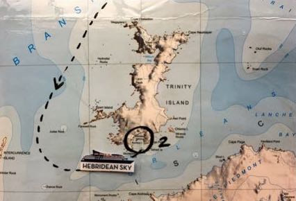
Mikkelsen Harbour 63 ̊54’S / 060 ̊47’W
lies on the southern coast of Trinity Island at the northern end of the Palmer Archipelago. The site was discovered by Nordenskjöld on his Swedish Antarctic Expedition of 1901-4. The harbour was used by whalers for mooring factory ships and named for Norwegian Whaling Captain Klarius Mikkelsen. On the island there is a gentoo penguin colony, an unoccupied Argentine refuge hut and an old radio mast.
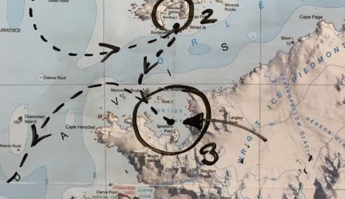
Curtiss Bay 64 ̊03’S / 060 ̊48’W
is about 4 nautical miles (7 km) wide, indenting the west coast of Graham Land just north of the Chavdar Peninsula. It is fed by beautiful glaciers such as the Samodiva Glacier, Pirin Glacier and the Tumba Ice Cap. The bay was originally listed as Bahia Inutil (useless bay) appearing on a 1957 Argentine chart. Yet this name being misleading as the bay has been used as an anchorage, it was renamed by the UK Antarctic Place-Names Committee in 1960 for Glenn Curtiss, an American aeronautical engineer who pioneered building seaplanes.
is about 4 nautical miles (7 km) wide, indenting the west coast of Graham Land just north of the Chavdar Peninsula. It is fed by beautiful glaciers such as the Samodiva Glacier, Pirin Glacier and the Tumba Ice Cap. The bay was originally listed as Bahia Inutil (useless bay) appearing on a 1957 Argentine chart. Yet this name being misleading as the bay has been used as an anchorage, it was renamed by the UK Antarctic Place-Names Committee in 1960 for Glenn Curtiss, an American aeronautical engineer who pioneered building seaplanes.