Day7
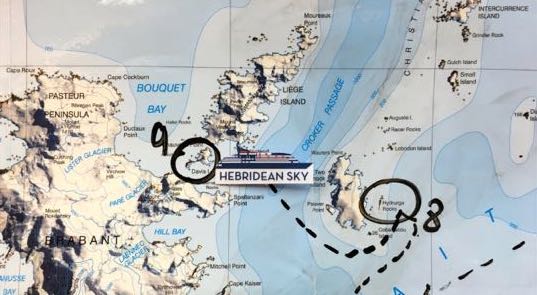
Hydrurga Rocks 64°08’S / 061°37’W
are a group of rocks lying in the northern part of the Gerlache Strait, and named after the leopard seal ́s scientific name Hydrurga leptonyx. These low, rocky islands rise to approximately 25m (82ft) above sea level and have a bare rock summit. Chinstrap penguins, blue-eyed shags and Kelp gulls all breed here. Leopard seals can be observed patrolling the shore and Weddell seals haul out on the cobble shoreline or on snow-covered areas above the beaches.
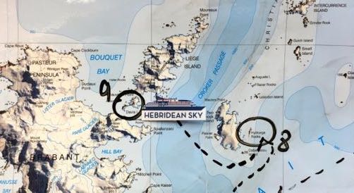
Davis Island 64°06’S / 061°59’W
An island about 2 mi long, situated in a position which blocks much of the channel between Brabant Island and Liege Island, in the Palmer Archipelago. The island was photographed and roughly charted by the Belgian Antarctic Expedition (BelgAE), 1897-99. The naming, by J.B. Charcot, leader of the French Antarctic Expedition, 1903-05, honors Walter G. Davis, director of the Argentine government meteorological office at the time of the French exploration. Source: https://geographic.org
An island about 2 mi long, situated in a position which blocks much of the channel between Brabant Island and Liege Island, in the Palmer Archipelago. The island was photographed and roughly charted by the Belgian Antarctic Expedition (BelgAE), 1897-99. The naming, by J.B. Charcot, leader of the French Antarctic Expedition, 1903-05, honors Walter G. Davis, director of the Argentine government meteorological office at the time of the French exploration. Source: https://geographic.org